GPR
inspection and mapping.
LiDAR
for 3D asset models.
Rail
inspection expertise.
Groundwave is a leading subsurface monitoring and detection contractor.
We provide advanced subsurface ground monitoring and surveying services that give you clear, accurate insight into what lies beneath your site.
Using industry-leading instrumentation, geophysical techniques, we help you understand ground behaviour, reduce risk, and make confident decisions throughout on your project.
From pre-construction investigation through to long-term asset monitoring, our team delivers reliable, actionable data to support safe, efficient and compliant delivery across rail, infrastructure, utilities, energy and civil engineering projects.
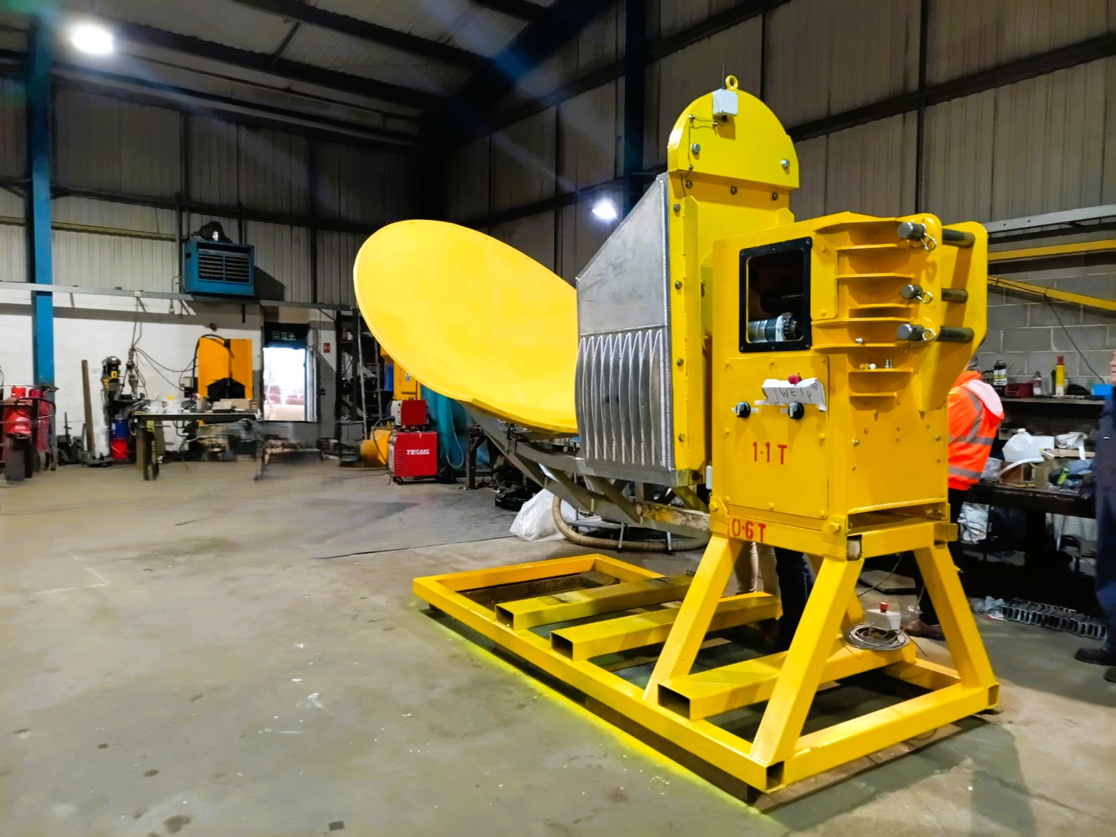
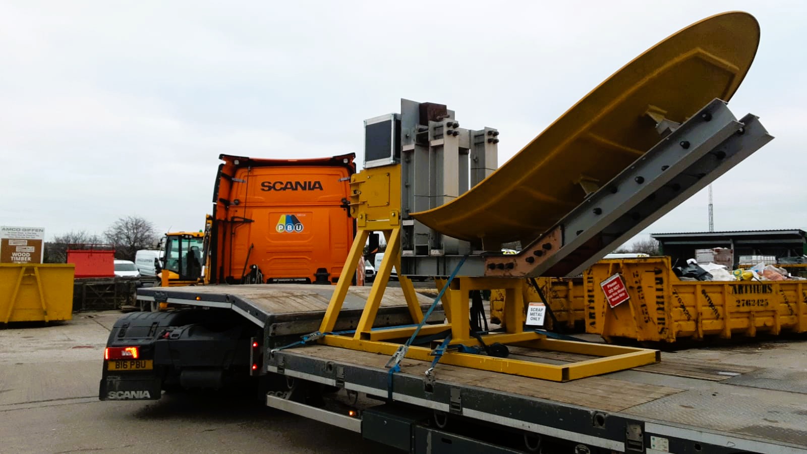
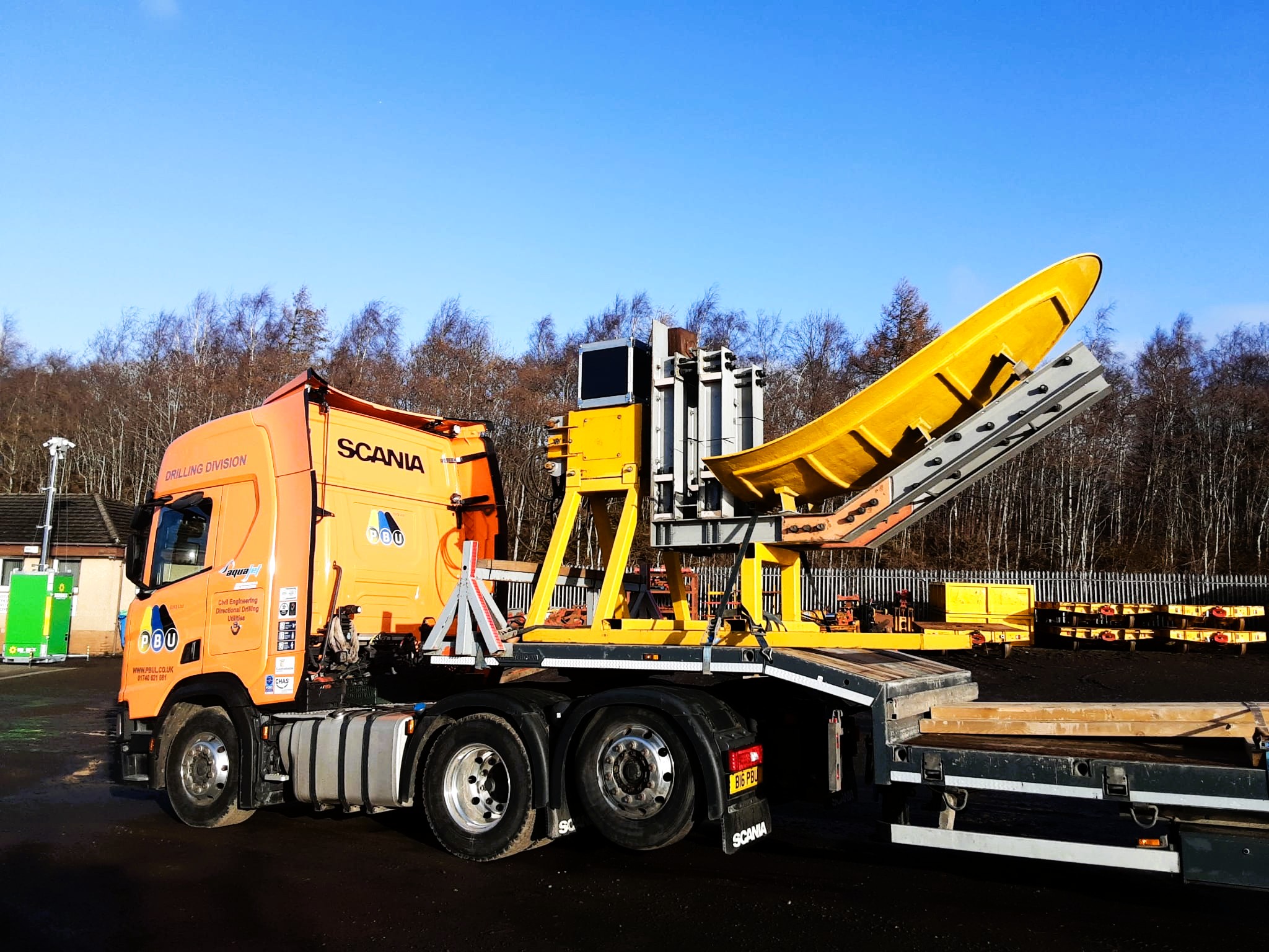
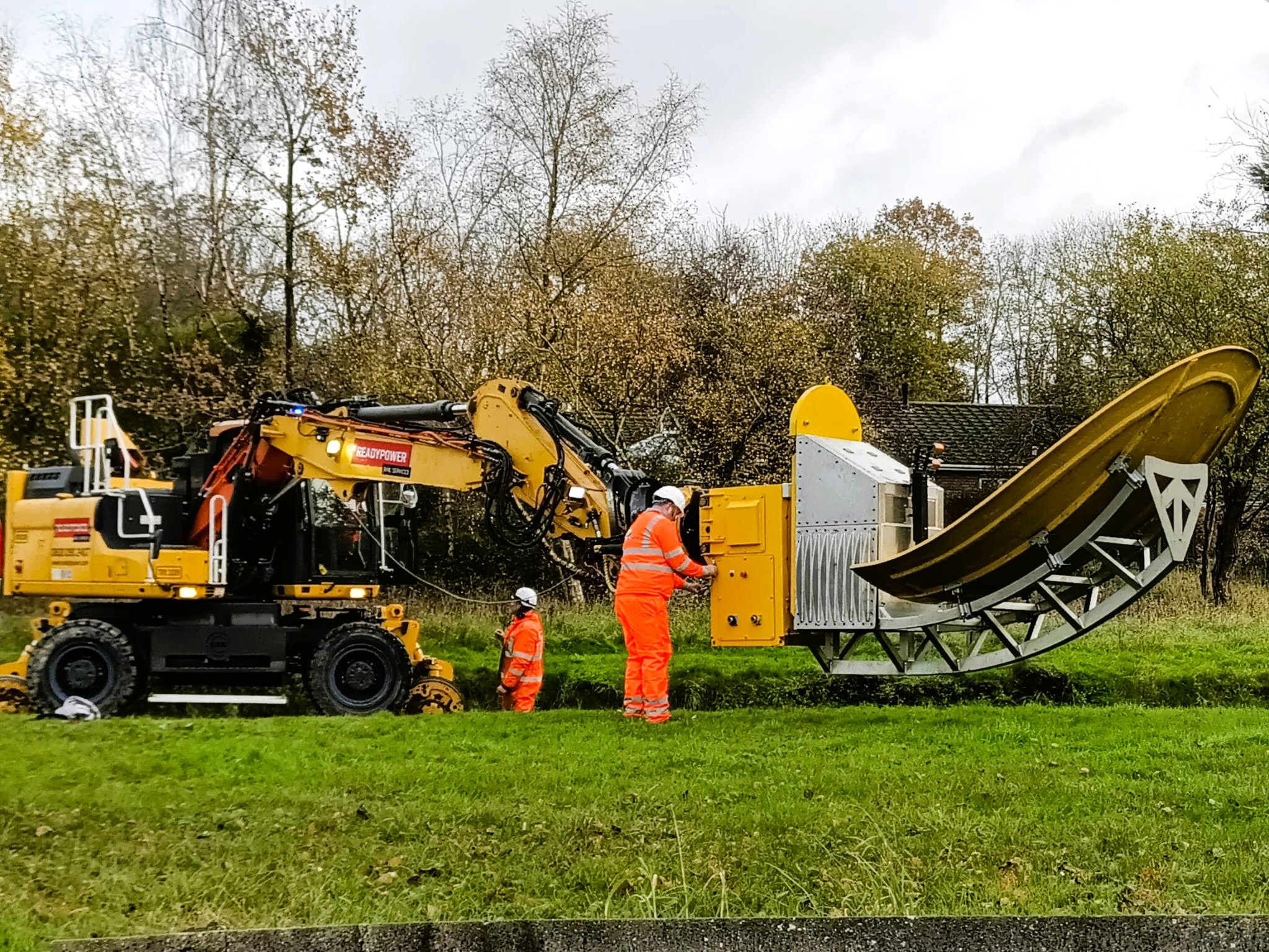
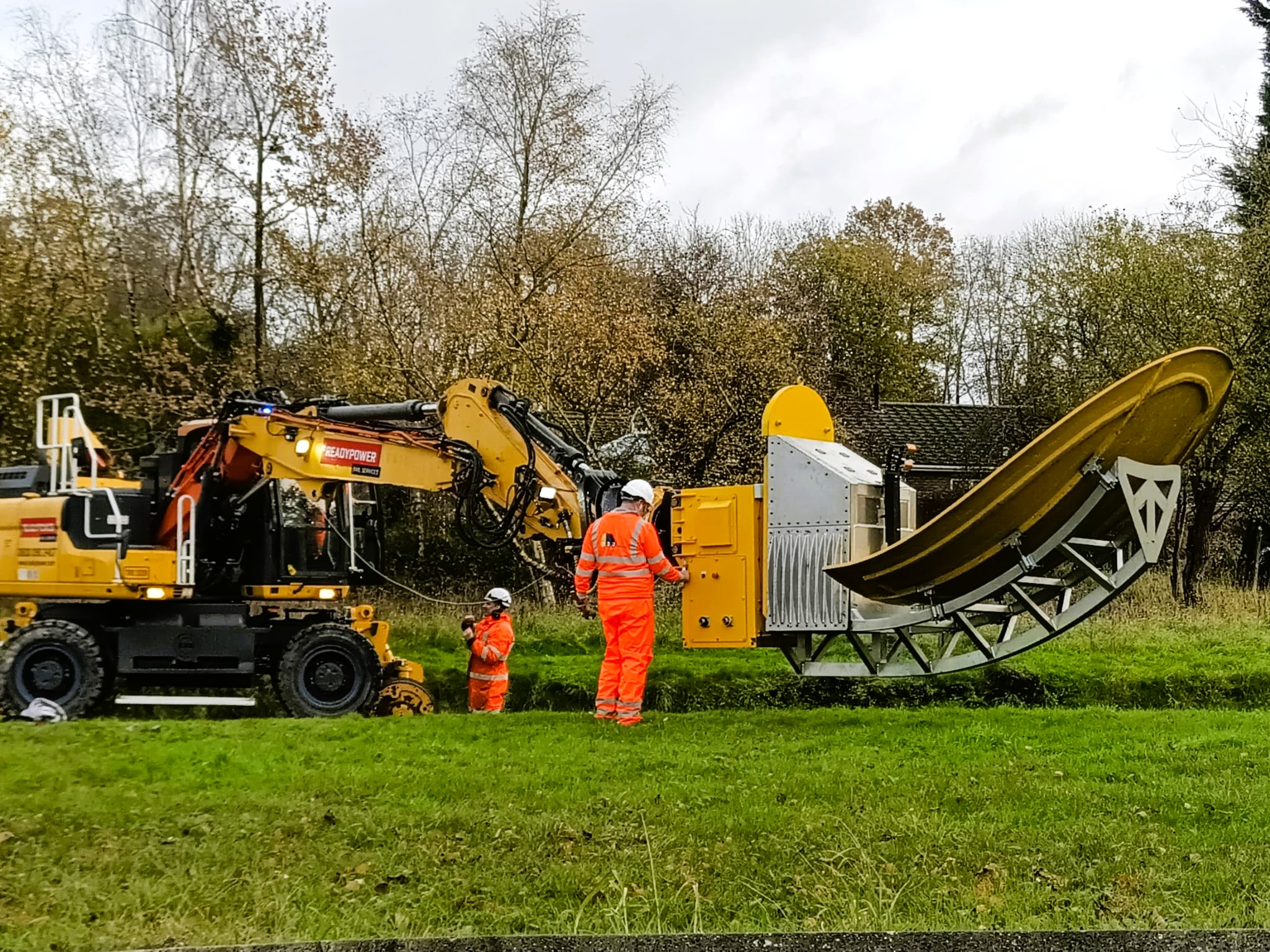
Tunnel Subsurface Inspection Radar
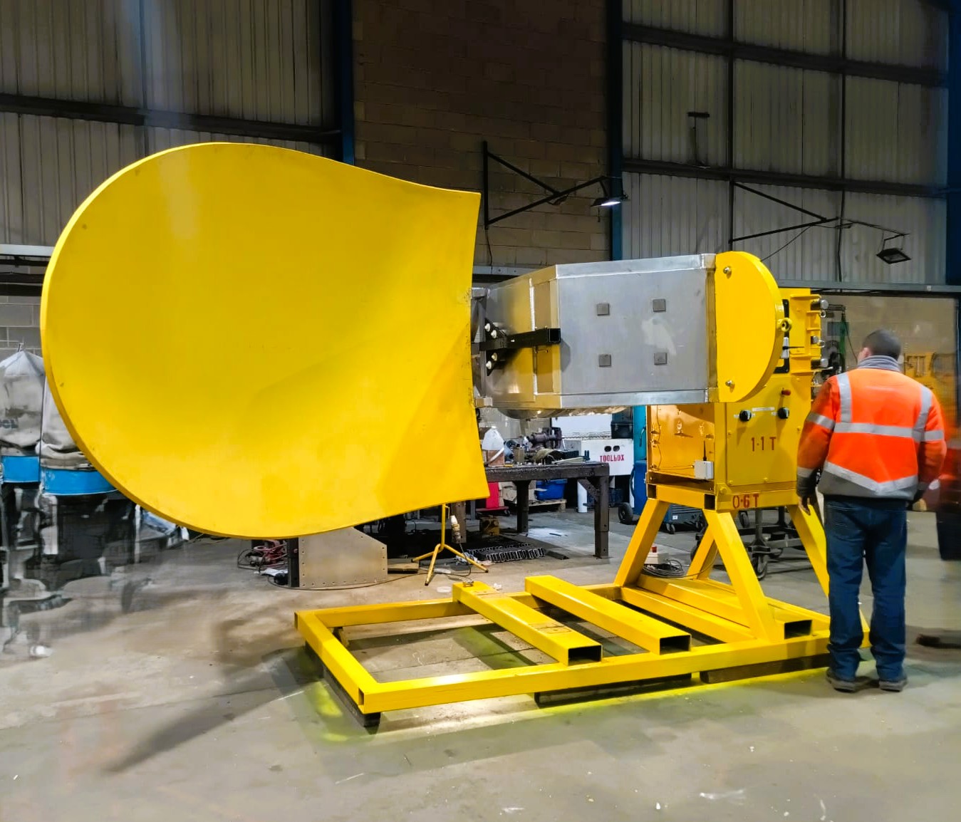
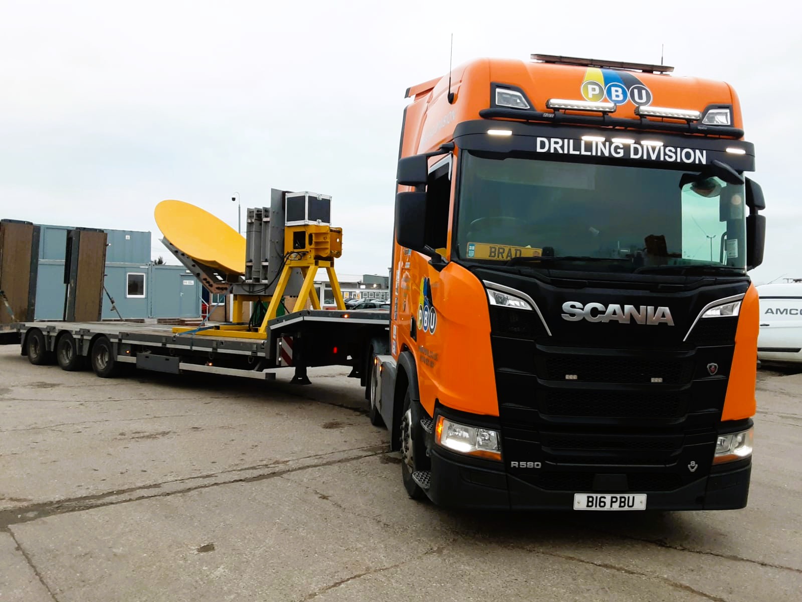
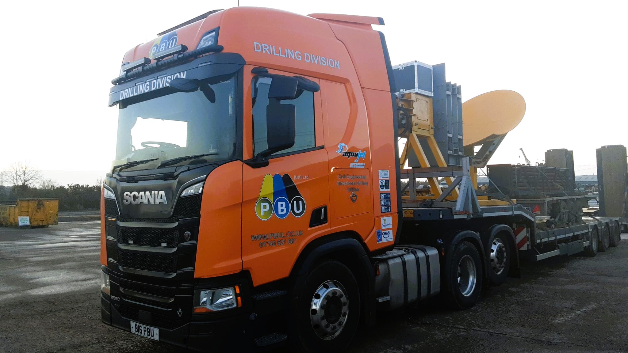
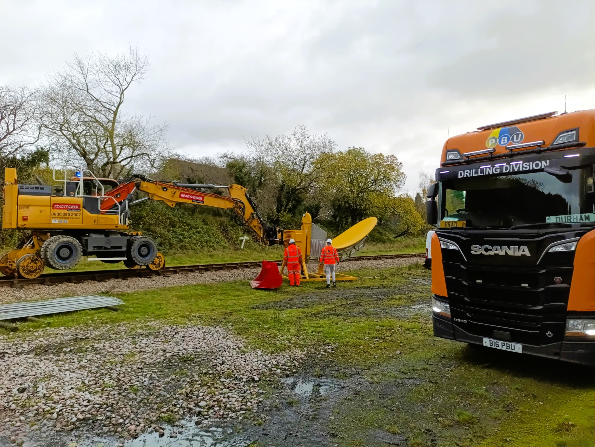
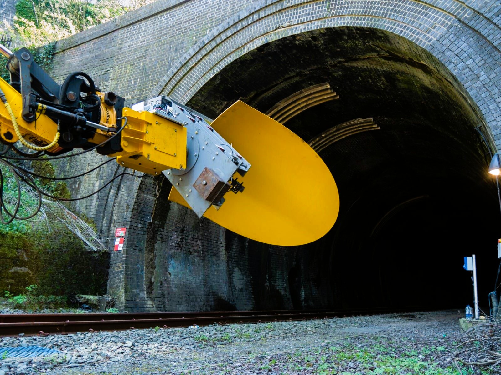
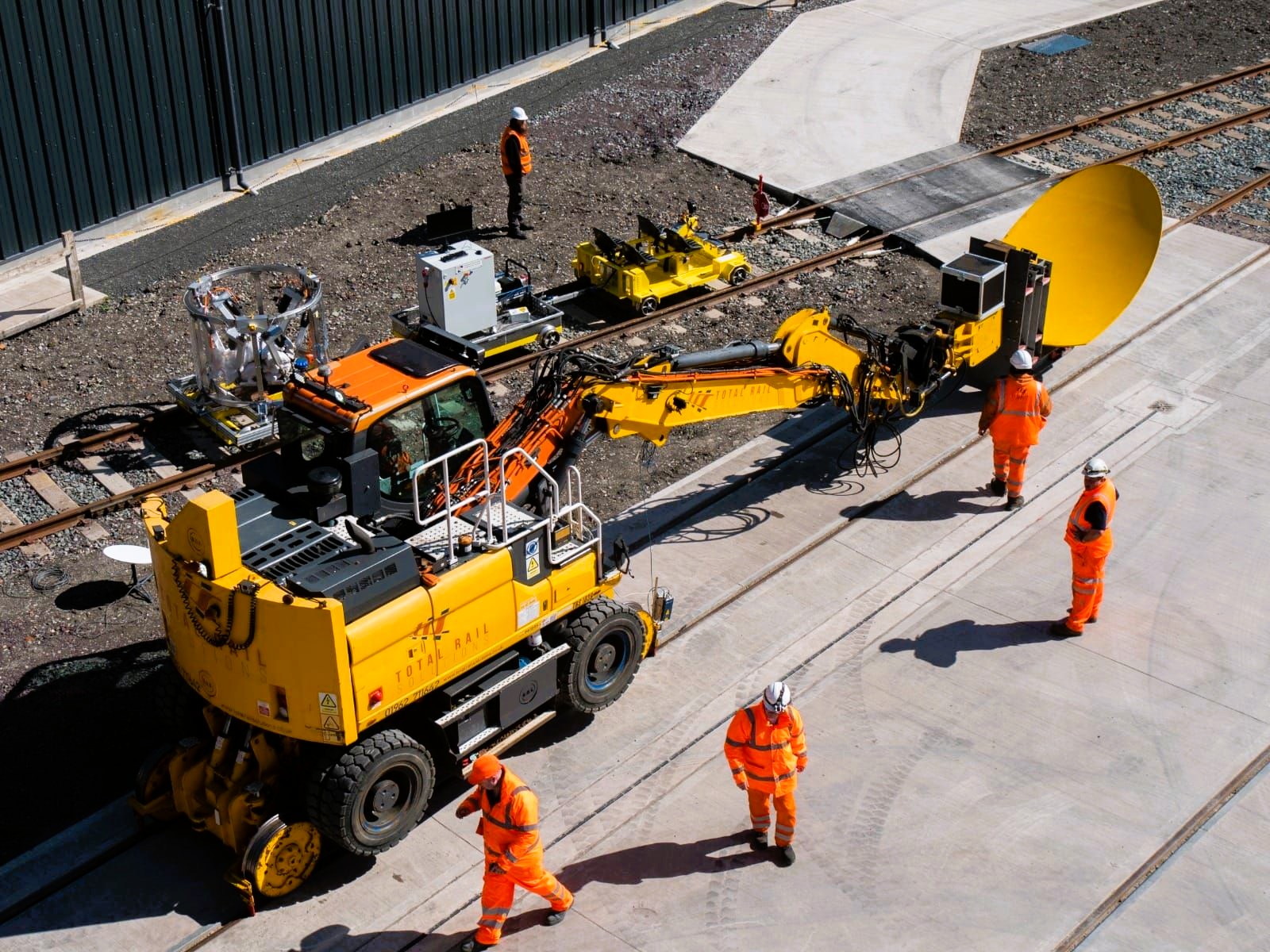
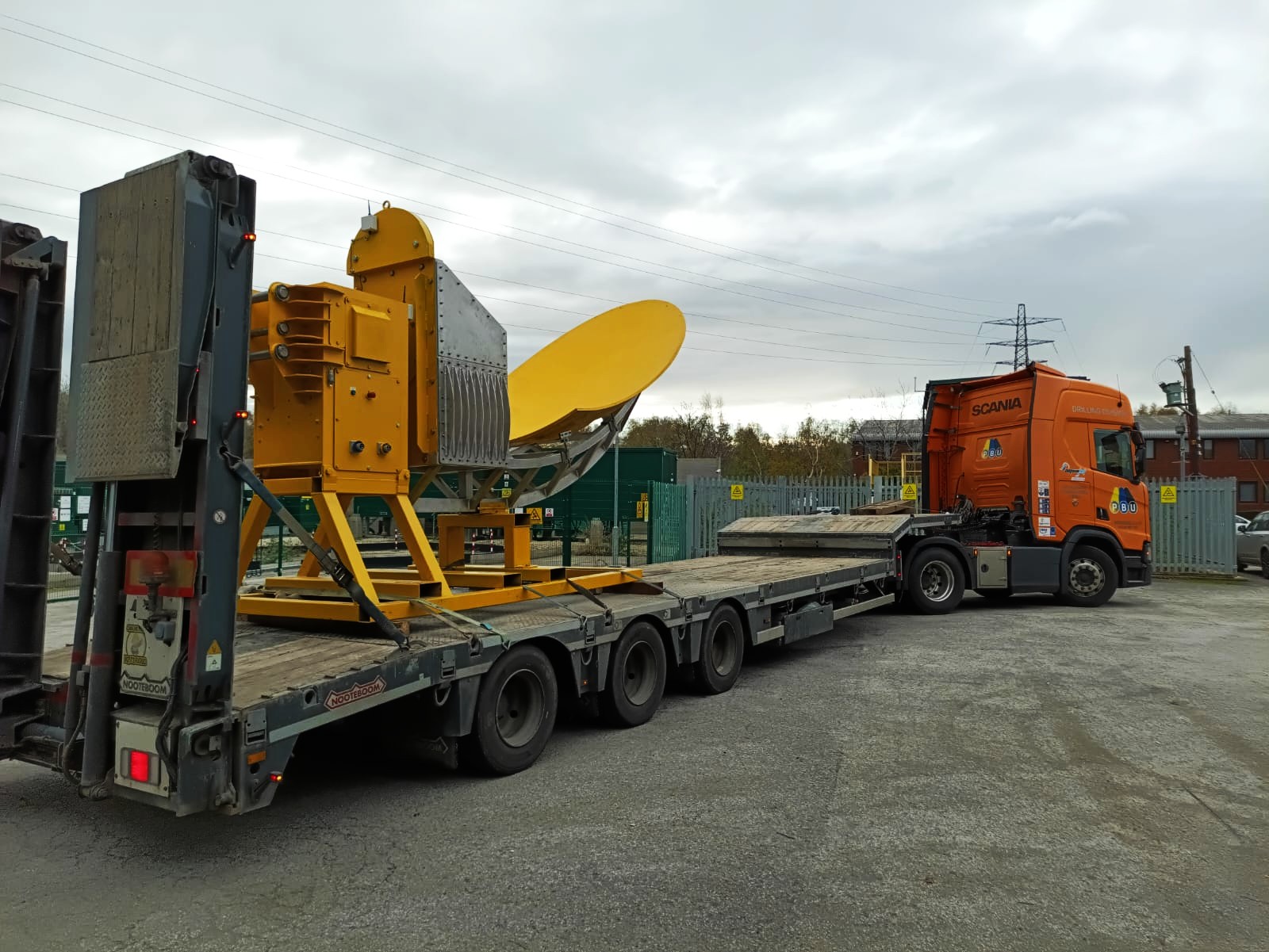
TSIR (Tunnel Subsurface Inspection Radar) is an advanced infrastructure monitoring system developed to support the inspection and assessment of railway tunnels and subsurface assets.
A key focus of the programme is the identification and investigation of hidden shafts and inaccessible underground features within tunnel environments. Designed for deployment on certified road-rail vehicles, TSIR combines high-resolution radar technology with intelligent data acquisition to provide rapid and accurate insight into structural conditions beneath and behind tunnel linings.
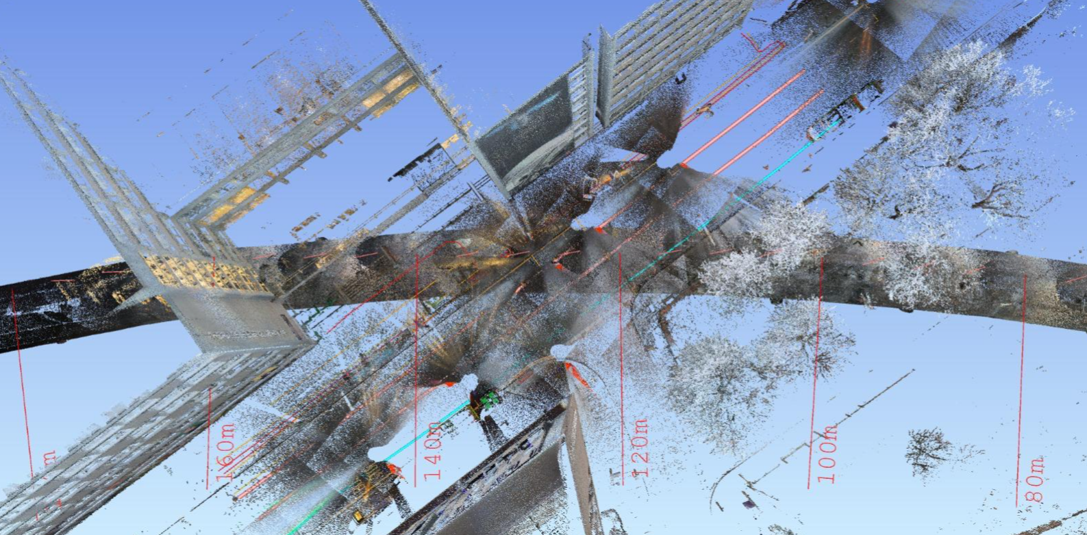
Alongside radar inspection capabilities, the system also integrates photogrammetry and LiDAR technologies to create highly detailed 3D models of tunnels and underground infrastructure. These digital models support enhanced asset visualisation, condition assessment, and long-term infrastructure monitoring, helping infrastructure owners identify voids, water ingress, structural defects, and buried anomalies before they develop into critical issues.
TSIR (Tunnel Subsurface Inspection Radar) is an advanced infrastructure monitoring system developed to support the inspection and assessment of railway tunnels and subsurface assets.
Read moreRead less
A key focus of the programme is the identification and investigation of hidden shafts and inaccessible underground features within tunnel environments. Designed for deployment on certified road-rail vehicles, TSIR combines high-resolution radar technology with intelligent data acquisition to provide rapid and accurate insight into structural conditions beneath and behind tunnel linings.
Alongside radar inspection capabilities, the system also integrates photogrammetry and LiDAR technologies to create highly detailed 3D models of tunnels and underground infrastructure. These digital models support enhanced asset visualisation, condition assessment, and long-term infrastructure monitoring, helping infrastructure owners identify voids, water ingress, structural defects, and buried anomalies before they develop into critical issues.
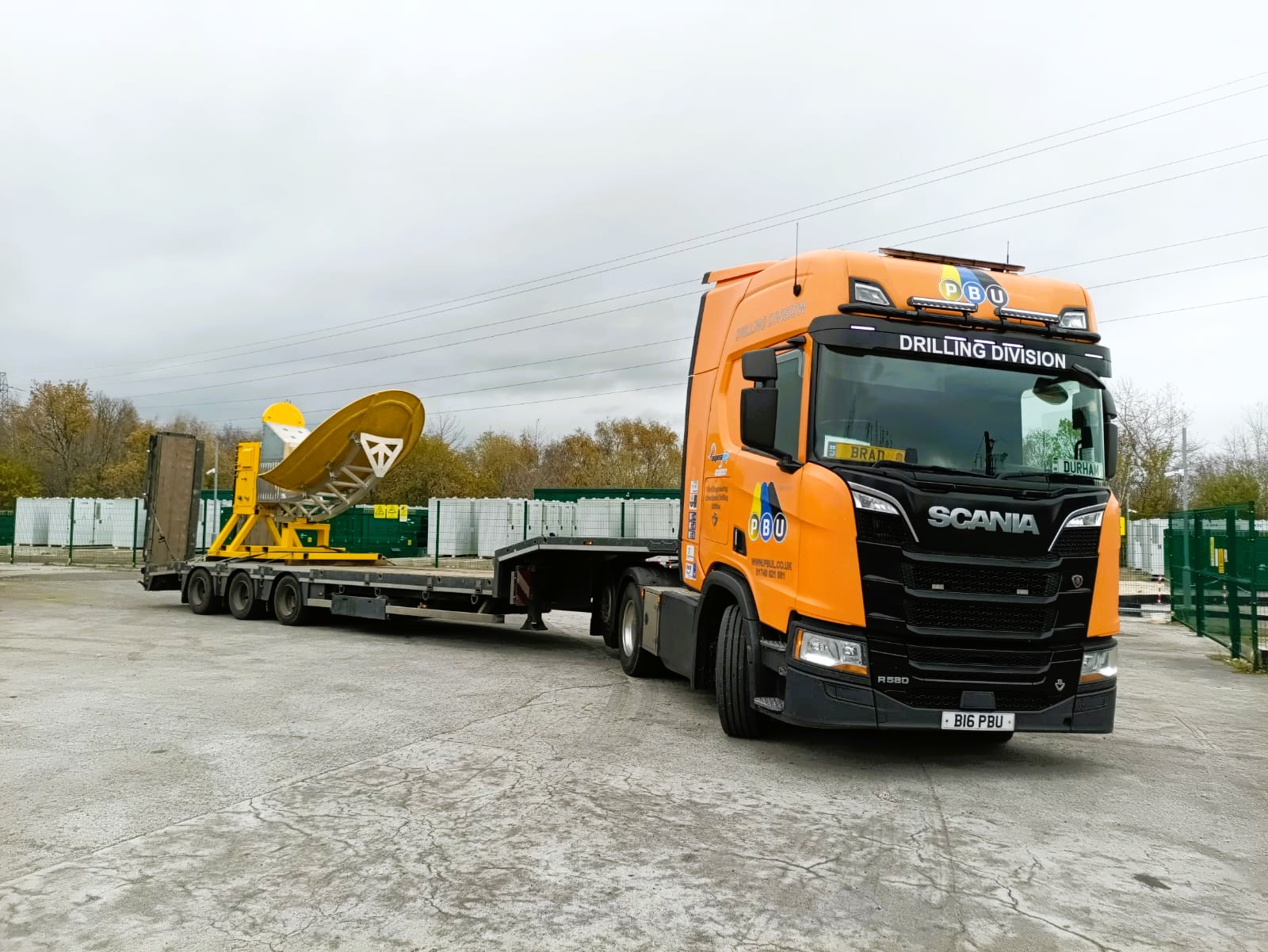
Rail Infrastructure Inspection System
TrueWaveGPR is an innovative ground penetrating radar system being developed for railway track and infrastructure inspection applications.
The project focuses on improving the detection and mapping of subsurface assets, drainage systems, voids, and buried infrastructure beneath and alongside rail corridors. By integrating advanced positioning technology, intelligent processing software, and high resolution radar acquisition, the system aims to deliver faster, more accurate, and more efficient rail inspections while reducing operational disruption.
The TrueWaveGPR development project is currently live, with ongoing testing, integration, and system validation activities underway. Key project milestones, technical updates, and development progress will be published here throughout the duration of the programme.
TrueWaveGPR is an innovative ground penetrating radar system being developed for railway track and infrastructure inspection applications.
Read moreRead less
The project focuses on improving the detection and mapping of subsurface assets, drainage systems, voids, and buried infrastructure beneath and alongside rail corridors. By integrating advanced positioning technology, intelligent processing software, and high resolution radar acquisition, the system aims to deliver faster, more accurate, and more efficient rail inspections while reducing operational disruption.
The TrueWaveGPR development project is currently live, with ongoing testing, integration, and system validation activities underway. Key project milestones, technical updates, and development progress will be published here throughout the duration of the programme.
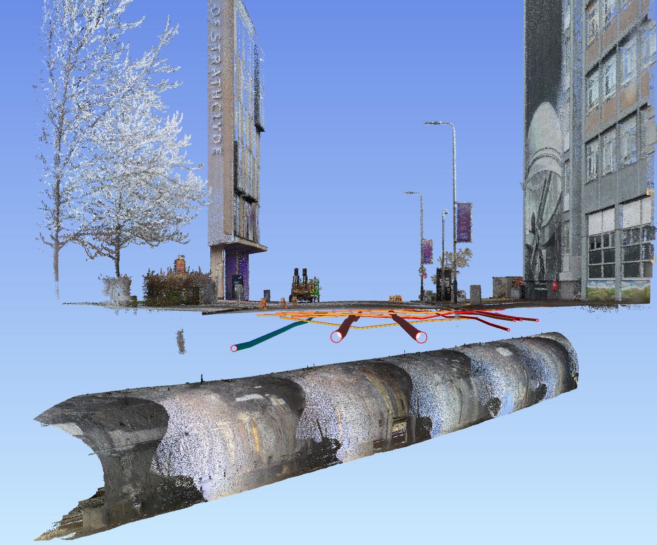
Utility Mapping & Digital Infrastructure Modelling
Groundwave Technologies Ltd provides advanced utility mapping and digital infrastructure modelling solutions designed to support safer and more efficient excavation planning within highways, streets, and complex urban environments.
Using high-density GPR mass array systems alongside LiDAR topographical surveying, we create detailed digital models of both surface and subsurface infrastructure.
These integrated datasets allow maintenance and engineering teams to effectively "bring the street or highway into the planning room," enabling excavation routes, work zones, and access strategies to be assessed within a controlled digital environment before works begin on site. By visualising underground utilities, surface constraints, and surrounding infrastructure in advance, project teams can better coordinate planned traffic management, reduce unnecessary excavation, and improve operational efficiency.
The overall objective of this approach is to minimise disruption to the public, reduce the risk of utility strikes, and significantly improve health and safety outcomes for field operations and excavation teams.
Groundwave Technologies Ltd provides advanced utility mapping and digital infrastructure modelling solutions designed to support safer and more efficient excavation planning within highways, streets, and complex urban environments.
Read moreRead less
Using high-density GPR mass array systems alongside LiDAR topographical surveying, we create detailed digital models of both surface and subsurface infrastructure.
These integrated datasets allow maintenance and engineering teams to effectively "bring the street or highway into the planning room," enabling excavation routes, work zones, and access strategies to be assessed within a controlled digital environment before works begin on site. By visualising underground utilities, surface constraints, and surrounding infrastructure in advance, project teams can better coordinate planned traffic management, reduce unnecessary excavation, and improve operational efficiency.
The overall objective of this approach is to minimise disruption to the public, reduce the risk of utility strikes, and significantly improve health and safety outcomes for field operations and excavation teams.